[SDG 13-2][PSHS Team 1] Satellite Imagery for Oil Palm Sustainability
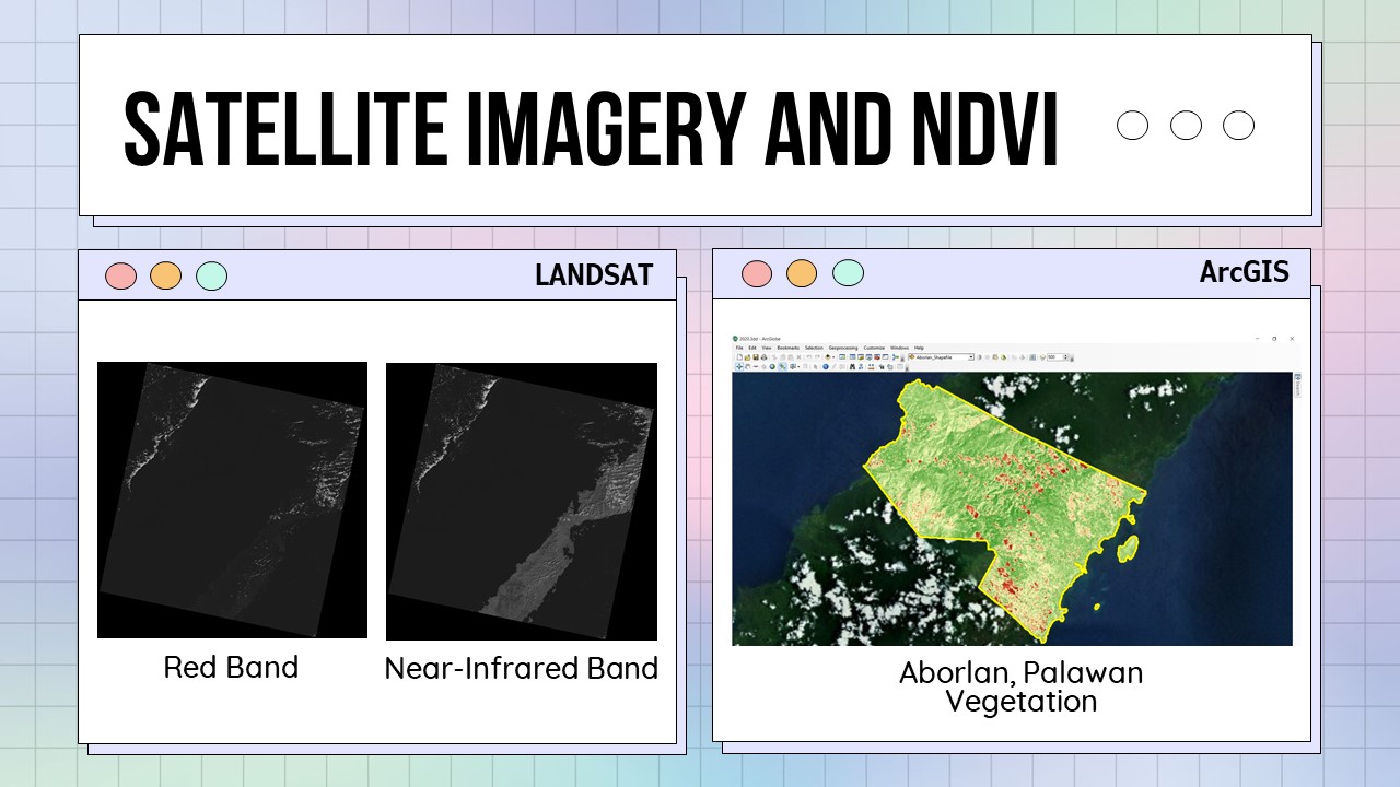
After two months of working, our team has collected satellite images of Aborlan, Palawan here in the Philippines. We have also obtained NDVI data from these images for our analysis of Land Use/Land Cover Change with respect to the expansion of oil palm plantations in the municipality. At present, we are working on the land cover classification of the area to specifically identify the oil palm plantations and other dominant land types.
As we continue with our research, we are looking forward that it can contribute to determining the sustainability of other oil palm plantations in the world 🙂
0 Comments